Dear Nashville resident: Does your neighborhood have bad traffic? If you answered yes, the city’s $9 billion light rail transit plan probably will not help you, one organization says.
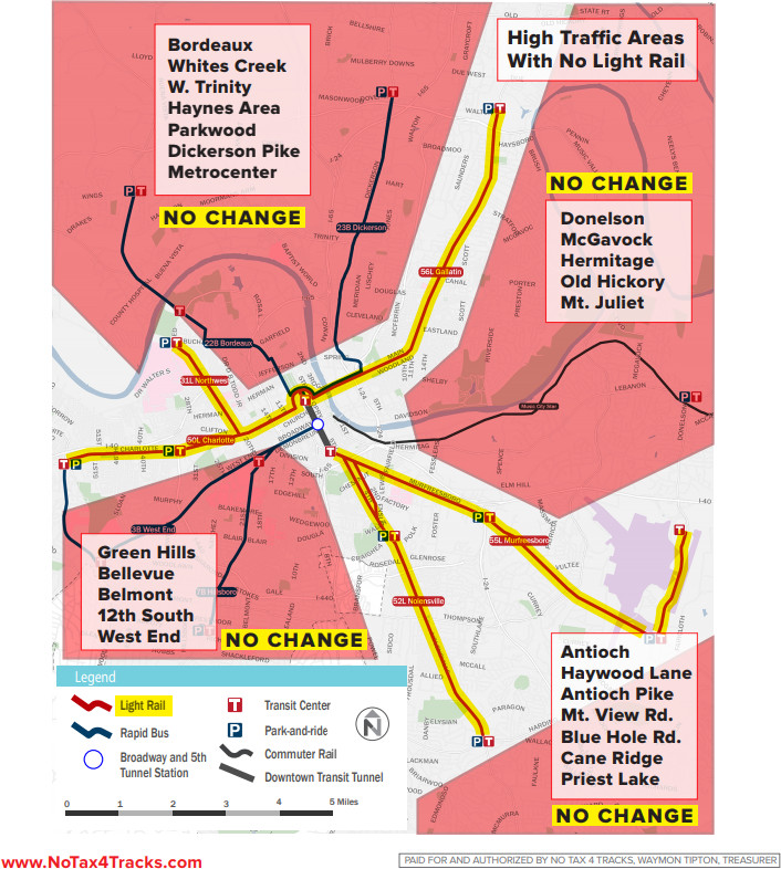
 NoTax4Tracks says only 3 percent of Nashville’s population will be served by the proposed light rail transit plan. The group has posted a map that shows the haves and have-nots when it comes to service.
The have-nots that have high traffic counts include Bordeaux, Whites Creek, W. Trinity, Haynes Area, Parkwood, Dickerson Pike, Metrocenter, Donelson, McGavock, Hermitage, Old Hickory, Mt. Juliet, Green Hills, Bellevue, Belmont, 12 South, West End, Antioch, Haywood Lane, Antioch Pike, Mt. View Road, Blue Hole Road, Cane Ridge and Priest Lake.
NoTax4Tracks urges residents to share copies of the map with others.
“We need everyone to see what they’d be getting and paying for if this passes May 1:
Only 3% of the population will be served and families in Davidson County would have to pay $43,608 more in taxes. That is a huge amount for a light rail system that leaves out so many neighborhoods.”
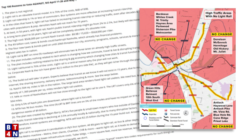
Better Transit For Nashville posted a top 100 list of why residents should vote against the plan on May 1. Reason No. 1: “The plan is not regional & does not address the main traffic issue: the masses of people traveling in & out of Nashville daily. The plan is only city. Any mass transit plan has to be regional.”
Reason No. 4: “The plan does not include anything related to technology, the driving force in traffic for the future. The plan was created by Megan Barry, the MTA bus agency & a small of group of small-town mayors WHO DO NOT LIVE IN DAVIDSON CO. Yes, that’s true; they created the plan; that info is on the pro website.”


The “artist’s view” in the 55-page document consistently showed the following DEFECTS in the proposed design:
1. Left-turn lanes abolished. Driving 5 miles with no left-turns would be a nightmare.
2. Street parking abolished. No place to drop off passengers; no place to park for local business; no place for buses to pull out of traffic for loading/unloading.
3. With no left-turn lanes and no street parking, when accidents happen or buses break down, the whole traffic stream grinds to a halt.
4. Overhead wires for electricity are shown. Where is the extra electricity capacity coming from (and the funding) for the heavy electricity load of trains during the busy part of the demand cycle?
5. No cross-street traffic is shown in the pictures. Will cross streets terminate at the train routes, further increasing congestion? If cross streets go through, how many signal gates are included in the budget?
[…] has previously pointed out that the light rail system would only serve 3 percent of Davidson County’s population and not […]
A typical progressive plan, out-of-sight expensive and totally useless for us, the “little” people.
[…] also reports that the neighborhoods with the worst traffic will see little relief from light […]